


D. Amari Cliffs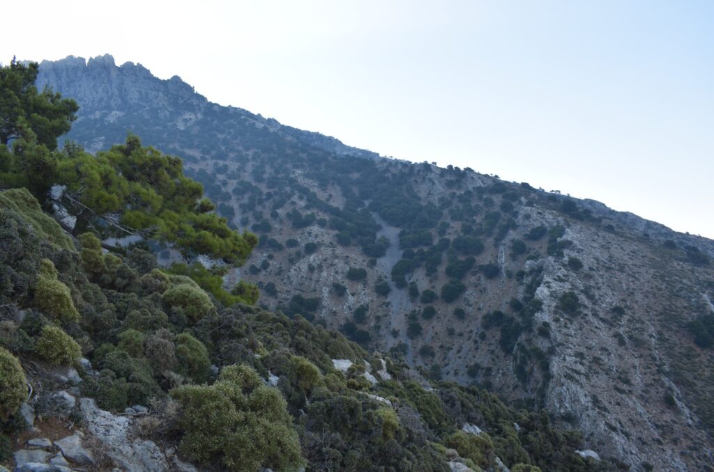
Amari is one of the most beautiful valleys in Crete. Thanks to the nature of its rocks and its geographical location, water is abundant—and with it, life. Located west of Psiloritis, the area receives high levels of rainfall and occasionally snow, which give rise to small streams and ultimately to the Platys River—one of Crete’s most important, which flows into the Libyan Sea. This water was once the wealth that allowed the villages
of the area to thrive.
Today, due to its relative inaccessibility, Amari has seen limited tourist development, but it remains rich in natural beauty and cultural heritage. Its geological formations are not particularly varied, with the region dominated by carbonate rocks of the Tripolis unit, flysch of the Pindos zone, and more recent sediments. Yet, the most striking feature is the sheer, vertical cliffs that begin
high up on the Psiloritis range and plunge down into the valley basin.
Although less visible than in the Gergeri–Kamares area, faults have played a similar role here—uplifting the mountains and sinking the basins.
The dramatic contrast between the raw ruggedness of the cliffs and the calm harmony of the valley is what makes Amari truly unforgettable.
D1. Fourfouras Coastlines
Fourfouras is a beautiful village nestled at the foot of Psiloritis, where steep cliffs rise just beyond the houses and stretch up toward the mountain’s summit. East of the village, remnants of an ancient coastline are preserved—layers of gravel and sand found at an altitude of about 600 metres
Fossils found in these deposits (sea urchins and bivalves) reveal that 6–7 million years ago, during the Miocene, this was the shoreline of ancient Crete.
D2. Pantanassa Formation
The reddish, loose sediments found around the village of Pantanassa are among the few sedimentary formations on Crete that were deposited on land, not under the sea. They date back to between 12 and 8 million years ago. The formation consists of loose sands, conglomerates, and clays, with thin lignite layers at the top—known collectively as the Pantanassa Formation.
The wealth of data derived from these layers has helped scientists understand this distant period when Crete was beginning to break away from the Aegeis landmass and take shape as an island.
A little further west lies the Patsos Gorge.
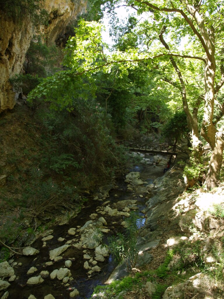
one of the most beautiful on the island, rich in water and lush vegetation. In a cave within the gorge, the Kranaios Hermes was worshipped in Minoan times; Today, the cave has been transformed into the small rock-cut church of Agios Antonios.
D3. Platania Gorge
The gorge, located just north of the village of Platania, differs somewhat from other Cretan gorges. It begins as an open ravine within loose Miocene deposits and then narrows into a short but very steep and confined gorge in the limestones of the Tripolis unit, before opening again into a wide valley filled with flysch rocks of the same group.
A beautiful trail climbs from the village up the northern slopes of the gorge, where visitors can admire a variety of wildflowers (orchids, bellflowers, etc.), old olive groves with centuries-old trees, and panoramic views of the Amari Valley. The entrance to the gorge is framed by vertical cliffs, their limestone walls tinted with the striking colors of iron oxides. Small and large caves, as well as towering vertical rocks, dominate the southern slopes.
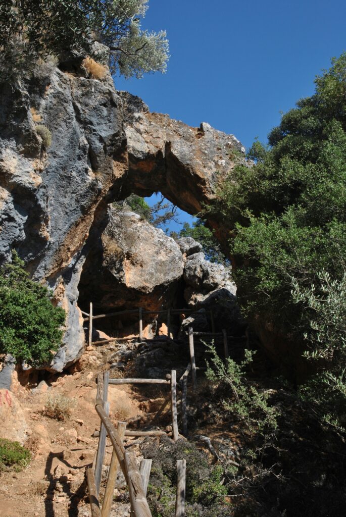
Beyond a stone arch and a natural arch formed by the trunk of a wild olive tree, the path becomes rather dangerous for inexperienced hikers.
The area is ideal for birdwatching—with griffon vultures and other raptors often present—as well as for observing Crete’s wild flora
D4. Tsikalas Wells
Above the cliffs of Vistagi, the contact between the Platy Limestones and the overlying Tripolis unit is visible—part of the Cretan Detachment Fault. This fault zone crushed the rocks into a broad belt, allowing water to remain trapped there for longer periods. At various points, such as at the “Wells of Tsikalas,” wells were dug to extract water
for livestock and mountain cultivation.
D5. Leska and Chambathoura
On the edge of the great cliff above Fourfouras are two small caves, Leska and Chambathoura. Leska lies directly on the cliff and requires advanced climbing skills to reach. It is a cave with several chambers and speleothems, mainly used in the past for maturing cheese.
Chambathoura is a much smaller cave with a single chamber, located on the hill above the cliff. Remarkably, local wisdom built a small mitato (a traditional shepherd’s stone hut) directly above the cave—one of the few on Psiloritis constructed from the limestones of the Tripolis unit—so that the cave could be used immediately for cheese maturation.
D6. The Cave of Pan
On one of the small plateaus of the mountainous zone of Fourfouras lies a small cave where, in antiquity, the god Pan was worshipped. Today, the cave is used by shepherds, while the place of worship has been transferred to the nearby chapel of Agios Myronas.
D7. Lavas of Kouroutes
Along the slopes of the provincial road after Kouroutes, heading toward the village of Nithavri, the landscape is dominated by reddish, rugged rocks that give the area a distinctive appearance. These rocks are lavas (basalts) that solidified in the marine realm of the Tethys Ocean about 65 million years ago. These unique alkaline rocks host several plant species of Crete, such as Aethionema saxatile.