


B. The Karstic Landscapes of Psiloritis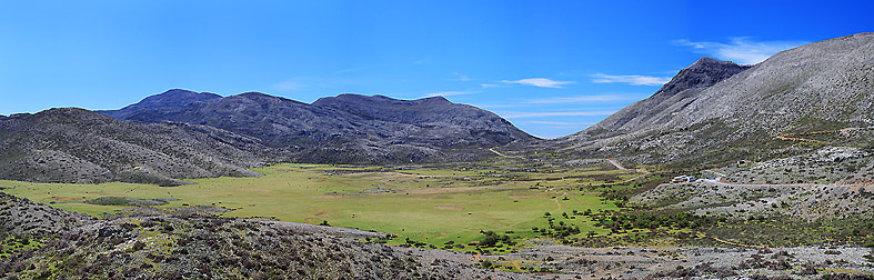
These environments and habitats are typically extreme and distinctive—just like the life forms that thrive within them. Karstic features can be either surface formations such as plateaus, dolines, sinkholes, and other similar structures, or subterranean ones like caves and chasms that captivate visitors with their dramatic and unusual terrain.
The dissolution of Psiloritis’ limestone, dolomite, and marble, especially in the mountain’s high-altitude zones, has shaped a multitude of such formations. These landforms define the mountain’s morphology and strongly influence the presence and evolution of life in all its forms—from the smallest beetle to humans themselves. The "Karstic Landscapes of Psiloritis" (setting aside for now the many caves and chasms that dot the park) include surface depressions of varying sizes, ranging from small hollows (known as arolithoi and chytrai), to sinkholes and troughs, and all the way to large plateaus such as Nida and Petradolakia.
In many areas, the lack of soil and the prevalence of hard limestone create surreal, striking landscapes. The “craters” of Kourouna and the Skinakas region have inspired myths about volcanoes on Psiloritis, though they are far removed from reality.
In these “karstic landscapes of Psiloritis,” the visitor encounters all these geomorphological forms and is awe-struck by the raw natural beauty and the richness of life they support.
B1. Nida Plateau
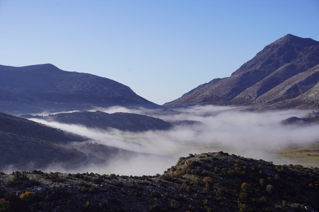
Nida plateau is the highest plateau in Crete, with an average altitude of 1360 meters. It is essentially a polje that was created due to karst erosion and the merging of neighboring, smaller depressions. Like the neighboring plateaus in Petradolakia, Nida plateau was formed at the contact of the two large carbonate units: the "Plattenkalk Limestones" and the "Tripolis unit", where small occurences of the "Phyllites-Quartzites" appear.
A crucial role in its formation was played by the large fault that delineates the eastern slopes of Mt. Psiloritis and the plateau itself. This fault caused the area of the plateau to subside in relation to Psiloritis, creating conditions for increased water retention and greater dissolution of rocks.
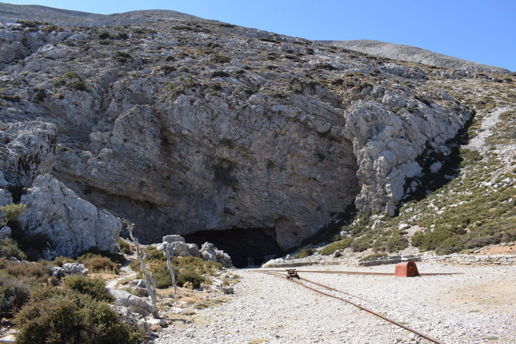
The entrance of the Idaean Cave is located precisely on this fault, which is also the reason it became exposed. Numerous sinkholes through which water disappears into the earth’s interior are found in the northern part of the plateau, an area that appears to have subsided more due to the same fault.
The image of the plateau varies with the seasons: covered in snow or clouds in winter, lush green with wild herbs and flowers in spring, shaded by the red maples in summer, or stark grey limestone in autumn—Nida is always a place of wonder.
Today, pastoral activity dominates in Nida, but in the past, its reddish soil was fertile ground for cereal cultivation. Though limited, the presence of water is sufficient to sustain both ecosystems and human activity. The most important springs are Varsamos in the south, Afentis Christos near the Idaion Cave, and Romana further north.
Across the plateau, the iconic mitata—traditional shepherds’ huts—add a humble yet deeply human touch to the wild mountain landscape. From the small ravines that begin or end here, one can either climb to the summit of Psiloritis, descend into the Rouvas Forest, or simply marvel at the Mesara Plain from this natural balcony.
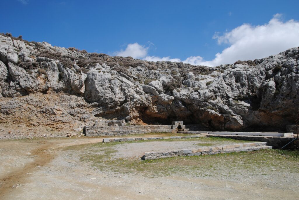
B2. Idaean Cave
The Idaean Cave is located on the edge of the Nida Plateau, on the steep eastern slope of Mount Psiloritis, formed by a major fault line in the region. Its entrance lies directly on the fault, and parallel fault planes are also visible inside the cave. At the cave’s entrance, which descends gently into a large chamber, as well as further inside, one can observe folds of the “Platy Limestones” unit.
Although not geologically impressive—lacking decoration or extensive development—the cave holds immense archaeological and cultural value. Mythology tells us that the Cretan-born Zeus found refuge in the cave as a newborn, to escape the wrath of his father Cronus. The native warriors, the Curetes, drowned out the infant’s cries with the noise of their weapons, while the goat Amaltheia nursed him until he grew up.
Excavations by Professor G. Sakellarakis confirmed the site’s significance: Idaean Cave was the most important sanctuary in Crete from the Minoan to the Roman period. Even today, the carved rectangular altar of ancient rituals still dominates the cave’s entrance.
B3. Petradolakia
Petradolakia is a rare karstic landscape dominated by the limestone rocks of the Tripolis unit and numerous surface depressions. Small and large dolines, sinkholes, and deep pits—crater-like formations that resemble volcanic features—compose a striking scenery that can be admired from the nearby peak of Skinakas, home to the observatory of the same name.
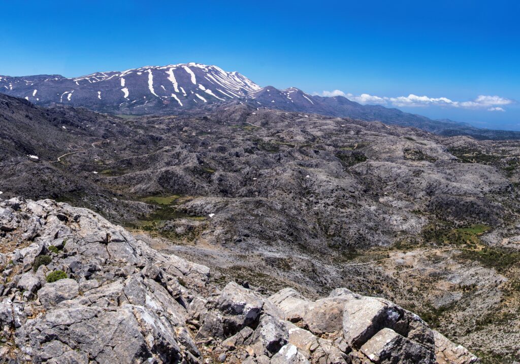
Beautiful folds develop in places within the typical Plattenkalk limestones of the western section, revealing multicoloured layers. In some locations, white siliceous aggregations are also visible—believed by some theories to have formed from sponge colonies of the ancient Tethys Ocean.
The scarce soil found on these plateaus supports a large number of flora and fauna species unique to Psiloritis. Among them are the Horstrissea dolinicola,Horstrissea dolinicolaa rare plant that grows exclusively in certain dolines near Skinakas, and the Psiloritis blue butterflyKretania psyloritawhich appears in large numbers at the end of spring—but only in the high plateaus of Psiloritis.
B4. The Cretan Detachment Fault
One of the best places to observe the great Cretan Detachment Fault—which separates the high-pressure metamorphic rocks of the Plattenkalk and Phyllite–Quartzite units from the non-metamorphic Tripolis limestones—is located next to the small chapel of Agios Fanourios in Petradolakia.
This fault uplifted the Plattenkalk rocks from depths of 30–40 kilometers to the Earth’s surface several million years ago.
The nearby spring owes its existence to this fault, which brings the permeable limestones of the Tripolis unit into contact with the underlying impermeable metamudstones of the Plattenkalk.
The vertical cliffs in this area are also home to one of Crete’s most characteristic aromatic herbs: diktamos or "erontas"Origanum dictamnus).
B5. The Agia Marina Metamudstone (Metaflysch)
Although it is the least extensive rock unit of Psiloritis, the metamudstone of the Plattenkalk unit—now a metamorphosed rock containing clay and limestone pebbles—is of the highest value to life.
Its presence at the eastern edge of Psiloritis is responsible for the appearance of many springs, as it blocks the water from the overlying Tripolis limestones from seeping deeper underground.
At Agia Marina, next to the archaeological site of Zominthos, there is a significant exposure of this rock, which also gives rise to the springs of the same name.
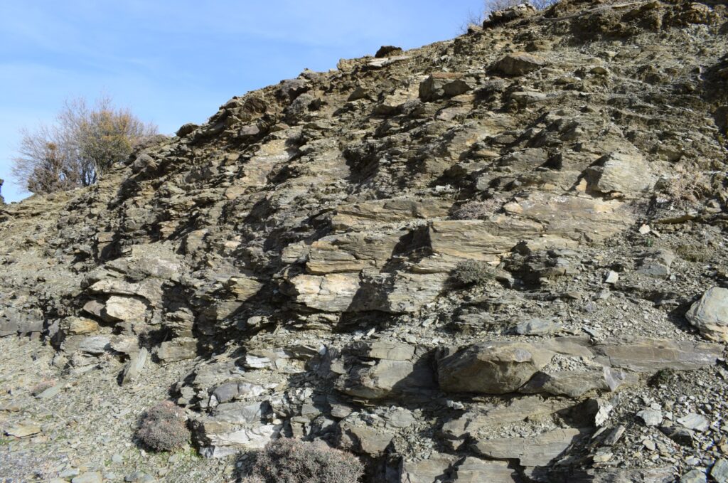
B6. Mygia Gorge and Folds
Mygia Gorge is a place deeply tied to the traditions of Anogeia. It has developed within the typical platy marbles, which are strikingly exposed on its vertical slopes. The intense pressure these rocks have undergone is clearly reflected in the countless angular, zigzag folds visible on the southern slope.
The gorge is not particularly narrow, except at certain points at its entrance and exit. It is, however, quite deep, with steep walls in many sections. A walking path along the upper northern slope—passing by old and new mitata (shepherd huts)—connects the gorge with other significant geosites in the area.
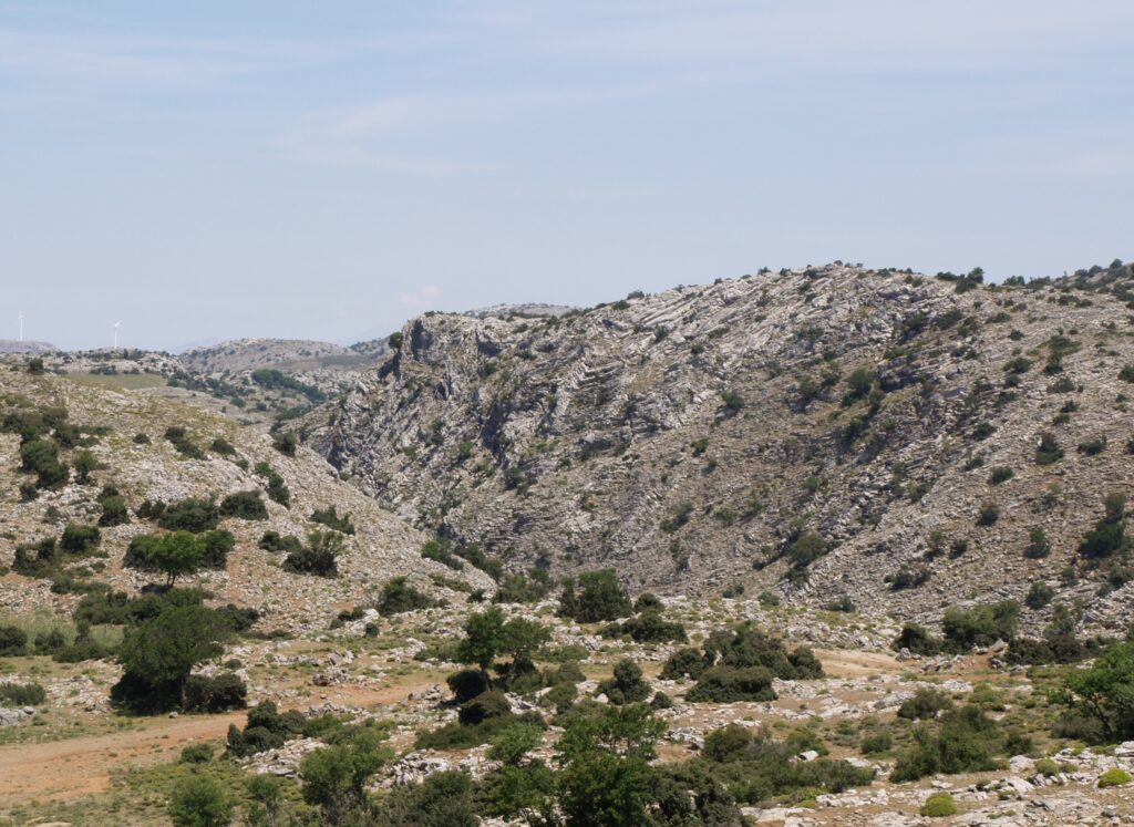
B7. The Folds of Stefana
Along the road from Anogeia to Nida, in the area of Stefana, prominent “N”-shaped folds are visible within the typical platy marbles. These are among the largest folds in the region, clearly observable both on the road slopes and in the topography of the surrounding hillsides.
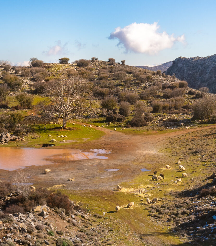
B8. Sinkholes of Stefana
One of the most characteristic plateaus of Psiloritis, clearly showcasing the impact of water on the “Platy Limestones”, is located in Stefana. Its easy access from the provincial road to Nida makes the surrounding area convenient to explore and offers a direct route to the Mygia Gorge.
This small plateau often becomes flooded, forming temporary ponds inhabited by frogs. Several active sinkholes are found in its central part and along the northern edge, near the road, where water disappears into the depths of the Earth.
Depending on the season, visitors will encounter wildflowers such as crocusesCrocus oreocreticusCretan colchicumsColchicum cretenseLegousia speciesLegousia and other plants of the local flora
From the small mitato (stone shepherd’s hut) with its characteristic milking pen on the northern edge of the plateau, a short trail leads to a large holm oak, offering a panoramic view of the northern section of the park—and in the evening, a sunset behind Cape Chania.
B9. The Sinkhole of Skinakas
On the trail from Petradolakia to the summit of Skinakas lies one of the most impressive and easily accessible sinkholes of Psiloritis. A narrow path crossing dolomites and limestones of the “Tripolis” unit through a semi-desert landscape leads to a shallow streambed and then to the entrance of the sinkhole. With a depth of about 20 meters and a diameter of around 10 meters, the sinkhole captivates with its sheer – and extremely dangerous – walls, lush vegetation, and the many birds it shelters. At its bottom, which narrows into a small cave, snow can persist until mid-summer.
B10. Dolines at Kourouna
Kourouna, a peak north of the main Psiloritis range, is formed by the typical platy marbles, whose horizontal bedding makes it look like a child’s block construction. Its high altitude prevents the growth of tree vegetation, allowing all the features of surface dissolution created by karst weathering to be fully revealed.
Numerous small and large dolines take the form of craters, visible mostly from the Psiloritis peaks or partially from the Livadiotiko or Zoniano aori (grazing land).