C. From the Mountain to the Plain
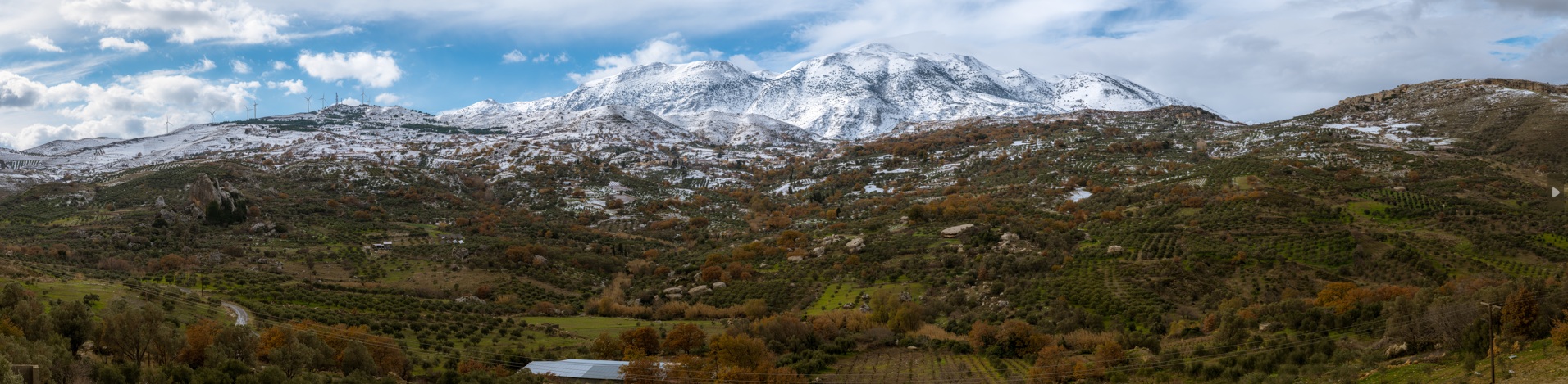
Transitional zones are often just as—if not more—fascinating than the regions they separate. The foothills of Psiloritis hold their own charm and unique characteristics that captivate the visitor. This is the threshold between high altitudes and the lowland zone—a meeting point and mixture of mountain and plain ecosystems.
In Psiloritis Natural Park, these areas possess an additional significance: they reveal the hidden history of the mountain itself—how it formed and came to stand out from the surrounding lowlands. In the eastern and southern part of Psiloritis, this transitional zone is extremely steep, shaped by major fault systems that sank the plains and uplifted the mountains several million years ago.
Moreover, due to these faults, many gorges cut deep into the mountain’s core, creating natural pathways into its secluded interior.
At the same time, this is the very zone where two of the region’s oldest human activities have long coexisted: agriculture and livestock farming. Numerous settlements have been established at the foot of the mountain, taking advantage of both its highlands and the fertile plains below. Many of them are especially picturesque, clinging to the steep slopes and cliffs.
C1. Almyros Spring
Almyros Spring could easily be the definition of a paradox. Located on the northeastern edge of Psiloritis, just a few hundred metres from the sea and the city of Heraklion, it discharges the largest volume of water in Crete—straight into the sea! Its water is brackish because, somewhere deep underground, it mixes with seawater.
The spring has two main recharge sources. One is the Psiloritis mountain range and its high plateaus—such as Nida—from where winter rainwater can reach the spring in as little as nine hours (!). The other is the surrounding mountains. Most of the water comes from sinkholes on Psiloritis, where it enters underground rivers (cave systems) and travels at great depth toward the spring. There, a major fault—the Tylissos–Krousonas fault, which marks the boundary between Psiloritis and the
Heraklion plain—traps the water, forcing it to rise to the surface, already mixed with seawater!
The spring’s discharge ranges from 3 to 40 cubic metres per second—amounting to hundreds of millions of cubic metres annually! At its outlet, a small artificial lake has formed, from which the river of the same name flows into the sea. Remarkably, in early spring—when the discharge is at its peak—the water is nearly drinkable. The Almyros wetland hosts a wide variety of bird species, depending on the season, as well as clusters of the endemic Cretan palm tree (Phoenix theophrasti),Phoenix theophrastiwhich grows only in Crete and at a single location in southeastern Turkey.
C2. Voulismeno Aloni
In the Cretan dialect, voulisma means subsidence, and Voulismeno Aloni literally translates as “sunken threshing floor.” Yet, this is no actual threshing floor, but a perfectly circular doline resembling a crater, located beside the old Heraklion–Rethymno national road, within the so-called “Tripolis” limestone formations.
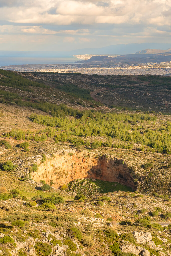
The sinkhole is several tens of metres deep, with walls that in many places are overhanging (with negative slope). It was formed by the collapse of the roof of a pre-existing cave. Today, the interior is easily accessible via a small footpath, and it is well worth walking down to admire this exceptional natural phenomenon. Voulismeno Aloni is often used by the Hellenic Speleological Society to train rope descent techniques.
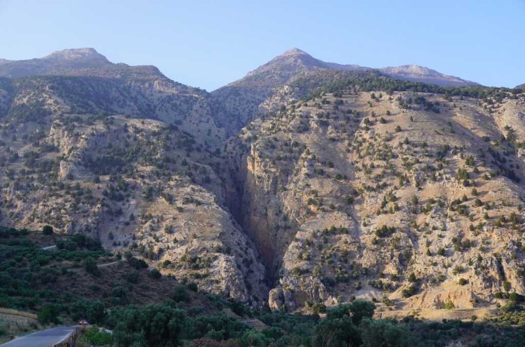
C3. Gonies Gorge
Like many others, Gonies Gorge was once the only route from the northeast into the interior of Psiloritis. Today, the main road leading to the villages of Mylopotamos still passes through this gorge, with its steep slopes and breathtaking cliffs.
The gorge cuts through the “Tripolis” limestone formations and begins at the Tylissos–Krousonas fault, which marks the boundary between the fertile lowlands and the mountainous zone. It ends in the Sklavokampos valley, near the Minoan country house.
C4. Krousonas Faults
Krousonas, one of the largest villages on the eastern foothills of Psiloritis, is built among ancient faults. Beyond the striking Tylissos–Krousonas fault, which marks the boundary between the mountain and the Heraklion plain, and several smaller faults running parallel to it, the area is also home to the prominent Cretan Detachment Fault, which dominates the landscape above the village.
A distinct horizontal line on the mountain slope—visible due to changes in vegetation and topography—marks the boundary between the “Platy Limestones” below and the overlying rocks of the “Tripolis” unit. In between, at various locations, small lenses of schists from the “Phyllites–Quartzites” unit also appear.
The Tylissos–Krousonas fault is highly significant for the region. Together with its parallel faults, it acts as a barrier to groundwater flowing from the mountains, creating underground reservoirs. These aquifers supply Heraklion and many nearby settlements with water through boreholes.
C5. Pites tis Grias (Grandma’s pies)
One of the most unusual geosites in Psiloritis is certainly the Pites tis Grias (Grandma’s pies) near the village of Prinias. At the bottom of a ravine lie large, round, flat rock formations with a distinctive groove along their perimeter—features that locals call “pites” or “the old woman’s breads.”
These white Neogene limestones (6–7 million years old), rich in fossilised sea urchins and bivalves, have rolled down from the top of Patela Hill, where the ruins of the Minoan city of Rizinia are also found. Over time, the massive blocks of limestone are eroded by water and become rounded. Often composed of two distinct layers, they are gradually carved along their separation plane, giving rise to the characteristic groove.
Access to the site is easy via the Heraklion–Moires provincial road, from which several rural roads pass through lush landscapes to reach the pites, the archaeological site of Rizinia, or Charakas—the towering limestone rock with striking vertical strata that rises at the centre of the ravine.
C6. The Messinian Evaporites
Evaporites are sedimentary rocks that often record critical environmental changes in Earth’s history. They are formed by the evaporation of seawater and consist of layers of gypsum, rock salt, and anhydrite.
The evaporites found around Agia Varvara were formed approximately five million years ago, during a period known as the Messinian. At that time, due to a combination of geological, planetary, and environmental factors, the Mediterranean Sea evaporated several times. The climate became extremely harsh, dramatically affecting life across the wider region. The repeated evaporation of seawater left behind massive deposits of evaporites, which today cover many Mediterranean islands as well as large portions of the present-day seabed.
These layers, which once lay at the bottom of the Mediterranean five million years ago, are now found at an altitude of 500 metres—clear evidence of the rapid uplift of Crete.
C7. The Gergeri Fault
Gergeri is another prominent village located on the southern foothills of Psiloritis. Above it rise the steep cliffs that define the mountain’s southern slopes. The cause is once again a major fault that caused the subsidence of the Gergeri area while uplifting the Psiloritis range. Impressive scree slopes, covered with reddish gravel and sand, extend across the mountainsides, where the road climbs toward the Rouvas Forest.
As with the Tylissos–Krousonas fault, the Gergeri fault blocks groundwater flowing from Psiloritis from reaching the sea. However, in this case, due to the presence of many impermeable sediments, the water is forced to rise to the surface, forming large springs.
In Gergeri and the surrounding villages, numerous fountains and watermills once operated—many of which have now been restored and are part of the local “Water Routes.”
Additionally, a small but well-organized Natural History Museum operates in Gergeri, housed within the local junior high school.
C8. Springs of Zaros
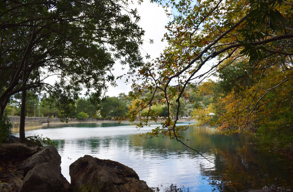
In the same fault zone as the Gergeri–Kamara fault system lie some of the largest freshwater springs in Crete, located in the area of Zaros. At Votomos, part of these springs forms an artificial lake that blends harmoniously with the rugged limestone landscape and is used for recreation. From the lake begins the scenic E4 trail, which follows the Agios Nikolaos Gorge and leads to the Rouvas Forest.
These springs are responsible for shaping one of Crete’s most beautiful and fertile landscapes—the wider area of Zaros. They also supply the new Faneromeni Dam with water.
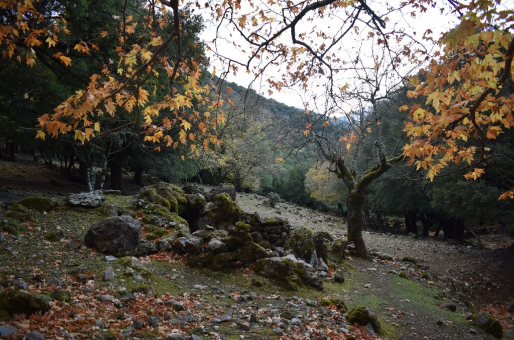
C9. Rouvas Forest and Agios Nikolaos Gorge
Rouvas Forest develops within a subsided basin—a small plateau—on the southern side of the Psiloritis range. Access is possible from several points: from Gergeri via a drivable rural road, from Skinakas via another rural road, and from Votomos Lake in Zaros via the E4 hiking trail that passes through the Agios Nikolaos Gorge.
This forest area has several remarkable features. It hosts large clusters of kermes oakQuercus coccifera) and, at its northern edge, one of the few surviving populations of the endemicZelkova abeliceaa rare tree found only on Crete. Also present is the rare Cretan orchid Cephalanthera cuculata, while the Cretan wildcatCephalanthera cuculatafinds shelter hereFelis silvestris cretensis. It is considered one of the most beautiful and emblematic landscapes of the island, with the chapel of Agios Ioannis and nearby freshwater springs.
The emergence of the Platy Limestones (Plattenkalk) below the overlying Tripolis unit plays a crucial role in the formation of these springs. From the southern edge of the forest begins the E4 trail, which crosses the Agios Nikolaos Gorge. It starts through lush streambeds, narrows through steep passages, and finally opens onto the southern slope of Psiloritis, ending at Votomos Lake in Zaros.
C10. Fossils of Sirenia
Within the Miocene sediments (9–5 million years old) of the Gergeri–Panassos area, the Natural History Museum of Crete has recently excavated bones (vertebrae, ribs, and teeth) belonging to a rather strange marine mammal. These are fossils of Sirenia—marine herbivores also known as sea cows—that lived 6–7 million years ago in the warm waters of the region.
Before the discovery of a complete skeleton and skull in the western Mediterranean, many believed the animal’s upper body resembled that of a human, while the lower part looked like a fish—thus giving rise to the myth of mermaids.
C11. Vorizia Gorge
One of the most beautiful and impressive gorges of Psiloritis is that of Vorizia, which begins just outside the village of the same name. Its entrance lies along the major Gergeri–Kamares fault, which has deeply fractured the rocks of the Tripolis unit.
At first, the gorge is quite steep, with small waterfalls and vertical slopes in the broken limestone. It soon opens into an area with large kermes oaks and rich vegetation, where many of Crete’s endemic plant species grow—such as Origanum dictamnusOriganum dictamnusand Petromarula pinnataPetromarula pinnataFrom there, experienced hikers can continue upward toward the Nida Plateau.
C12. Kamares Gorge
Kamares Gorge, like the nearby Voriza Gorge, cuts through rocks of the Tripolis unit. It begins just west of the village of Kamares and leads upward to the Kamares Cave.
It is wilder and more dramatic at its entrance than Voriza, and the path that crosses it is “forced” to follow, for much of the way, a series of characteristic stone steps. From a distance, the gorge appears as a crack in the limestone slope of the mountain and is the largest of three gorges found in the wider area.